top of page

Sistem Peringatan Dini Banjir

This Flood Early Warning System is capable of helping you detect, monitor, and provide early warnings if there is a potential flood in a certain area.
Plug & Play
Access Anytime
& Anywhere
Mertani
Waterproof Enclosure

Challenge

  • Based on the report presented by Rodriguez, et al. (2009), it is stated that in 2008, Indonesia was among the top 10 countries in the world that consistently experienced natural disasters.

  • The analysis of data issued by the Center for Research on the Epidemiology of Disasters (CRED) in 2010 shows that floods are the most frequent type of disaster occurring in Indonesia, accounting for approximately 34% of all disaster events in the country.

  • An early warning system for floods needs to be established to be used as an integrated flood forecasting tool and to minimize the impact or risks that occur in the community.

Benefit
AWLR + CCTV_edited.png
EWS (2) (1)_edited.png

Sistem Peringatan Dini Banjir

Definition
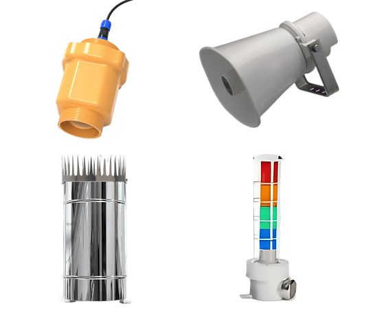
Flood Early Warning System based on water level is a technological solution installed in flood-prone areas. This technology utilizes the AWLR telemetry system, which allows sensors to detect changes in river water levels. The digital data detected by these sensors is then sent online and in real-time to a server. By using solar panels, this device is capable of continuously monitoring the river's water level. Moreover, the system is also equipped with sirens that will activate if the potential for a flood is detected. To provide a clearer visual representation, the device is equipped with CCTV cameras, allowing the river's water level to be monitored through video displays from the device.
​
Legal Basis:
  • Undang-Undang Republik Indonesia Nomor 24 Tahun 2007 Tentang Penanggulangan Bencana. see details

Schematic Sistem Peringatan Dini Banjir

Skematik Mertani_Sistem Peringatan Dini Banjir
Schematic Sistem Peringatan Dini Banjir
Sistem Peringatan Dini Banjir consists of several main parts :
 
1.Water Level Sensor
Water level sensor is placed in flood-prone locations, such as riverbanks. The sensor will continuously monitor the water level and detect any changes.

2.Automatic Water Level Recorder Telemetry

The sensor will transmit water level data to the AWLR telemetry system. This telemetry system will convert the sensor data into a digital format that can be processed.


3.Online and Real-time Server
Digital data from the sensors will be sent online to a central server. The server will receive real-time data and store it for further analysis.
​
4.Water Quality Monitoring
The system will use energy from solar panels to continuously monitor the river's water level. This information will be periodically updated at specific intervals.
​
5.Data Analysis
The collected data will be processed and analyzed on the server. The analysis will include evaluating water levels and predicting potential floods.
​
6.Warning Sirens
If the data analysis indicates a potential flood danger, the system will activate warning sirens. The sirens will emit alert sounds that can be heard by nearby residents.
​
7.PTZ/ROTATED CCTV Monitoring
The system is also equipped with CCTV cameras that monitor the surrounding conditions. The cameras will provide live visuals of the water level and the situation around the location.
Benefit
Sistem Peringatan Dini Banjir | Mertani

Remote Terminal Unit (RTU)

Details
  • Mertani data logger
  • Power unit 
  • Data Communication (2G, 4G, LTE)
  • Panel box
  • Wiring system
​
*RTU installation can be adjusted to field conditions
Benefit

Sistem Peringatan Dini Banjir

Spesifications
  • Protocol communication RS485 Modbust
Parameters:
  • Ground Water Level (TMAT)

  • Canal Water Level (TMAS)

Sistem Peringatan Dini Banjir CCTV | Mertani
Sistem Peringatan Dini Banjir Sirene | Mertani
Sistem Peringatan Dini Banjir Holykell | Mertani
Benefit
Dashboard Mertani.png

Software System

Spesifications
  • Displaying water level data and photos of the surrounding conditions sent by the Water Level Sensor System.
  • Capable of requesting the Water Level Sensor System to send the latest data.
  • Capable of activating the Siren Unit.
  • Providing a database for the data sent by the Water Level Sensor System.
  • The monitoring application can be accessed through a website or smartphone.
​
Dashboard Mertani ( Desktop )
Application Mertani (Android)
​

Spesification Sistem Peringatan Dini Banjir

MERTANI-EWS-SIRENE.png

Spesification

Details Spesification Sistem Peringatan Dini Banjir Sirene
 
MERTANI-EWS-TINGGI MUKA AIR (1).png

Spesification

Details Spesification Sistem Peringatan Dini Banjir Tinggi Muka Air
MERTANI-EWS-TMA+SIRENE.png

Spesification

Details Spesification Sistem Peringatan Dini Banjir Tinggi Muka Air + Sirene
WhatsApp
bottom of page