

Challenge
-
Monitoring Landslide Prone Areas
Areas with high rainfall or geographical conditions such as steep slopes are very vulnerable to landslides. Therefore, real-time land monitoring is crucial to detect ground movements that have the potential to cause landslides, so that preventive measures can be taken immediately. -
Landfill Monitoring
Poorly managed landfills, especially in steep areas, are at risk of waste avalanches during the rainy season. Continuous monitoring helps prevent incidents and protects workers and the environment. -
Landslide Detection in Steep Farmlands
Farmlands on steep slopes are prone to landslides during rains. Our monitoring system detects soil movement early, giving time for preventive action.


Landslide Early Warning System
Definition
The Landslide Monitoring System is designed for quick and accurate detection of potential soil movement. With real-time monitoring, this device provides early warnings when changes are detected that could lead to landslides. This solution is ideal for hilly areas, agricultural land, or infrastructure projects to help minimize disaster risks and protect the safety of the environment and critical assets.
Legal Basis:
-
Law of the Republic of Indonesia Number 24 Year 2007 on Disaster Management. see details
Landslide Early Warning System
Details
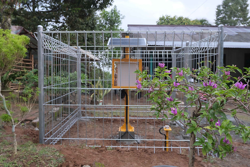
-
Mertani data logger
-
Power unit
-
Data Communication ( 2G, 4G, LTE, Point to point, GSM , LoRa, Satellite Communication (Starlink), Bluetooth, dan WiFi)
-
Panel box
-
Wiring system
-
GPS
*RTU installation can be adjusted to field conditions

.png)
Landslide Early Warning System Sensor
Sensors:
-
Inclinometer
-
Tiltmeter
-
Extensometer
-
Rainfall
-
Soil
Additional Part:
-
Siren
Software System
Specifications:
-
Harvest data from the field
-
Realtime monitoring (chart, raw data, and downoad data)
-
Get Quic notifications of real-time data
-
Sensor and device management
-
Daily, monthly, and annual data report
-
Device Location tracking (GPS)
-
Forecast (Ongoing)
-
Notification Early Warning System
.png)
Products & Solutions Related to Early Warning


